
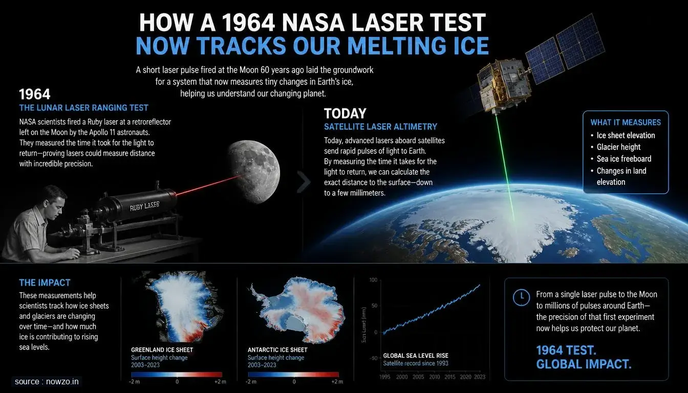
Back in 1964, NASA aimed a laser beam at a satellite and watched it bounce back—a dazzling feat that felt more like science fiction than practical science. Today, that same laser technology isn't just a relic of space-age curiosity; it's helping scientists track the alarming melt of polar ice with stunning accuracy.
Key facts
- NASA first bounced a laser off a satellite in 1964
- The same laser technology is now used to monitor ice melt
- Precise measurements help track polar ice loss over time
From Space Experiment to Climate Guardian
What started as a demonstration of precision and innovation has quietly become one of our most reliable tools in climate science. Lasers, once symbols of futuristic ambition, now pulse toward Earth's frozen regions, returning data that tells a urgent story of change.
How It Works Today
Modern satellites equipped with laser altimeters fire beams toward ice sheets and glaciers. By measuring how long it takes for light to return, scientists calculate minute changes in elevation—revealing not just how much ice has vanished, but how quickly it's happening.
Why It Matters Now
As temperatures rise and sea levels become a growing concern, this decades-old technology offers something invaluable: certainty. In a field where margins matter, these laser measurements provide unambiguous evidence of ice loss, helping researchers separate signal from noise in the complex narrative of climate change.





Comments